Aerial Inspection for Chicago Buildings
Facade, roof and thermal surveys flown by a commercial pilot. The parts of a building a ladder can’t reach and a spotting scope can’t resolve, documented at full resolution, with a written report and clear next steps.
What a walk-around can’t tell you
Terracotta twelve stories up
Spalling, open joints and shifted units show from the air long before they show from the sidewalk. Renting a swing stage to find out costs more than the survey.
Water you can’t see at noon
Wet roof insulation looks like dry roof insulation in daylight. After sunset, in infrared, it glows. Patch where the water is instead of replacing a roof where it might be.
Heat leaving through the walls
Missing insulation, failed seals and thermal bridging show as warm scars on a cold facade. A Chicago winter is the best season to find them.
No record to compare against
A photo dump from a hobby drone is not a survey. Fixed standoff and overlap make this year’s imagery comparable with next year’s, elevation by elevation.
That is why GPIS added a partner who flies for a living.

Commercial Pilot, Airplane Single- and Multi-Engine Land
Instrument; Certified Flight Instructor
FAA Part 107 Remote Pilot in Command, since 2022
Camber Aerial LLC, Illinois
Commercial liability. Certificate and additional insured on request
LAANC authorizations secured before the flight date
640 × 512 radiometric, paired with 48 MP visual on the same gimbal
Most drone operators hold a Part 107. This one flies for a living.
Camber Aerial is run by Juan Lazo Jr., a commercial pilot with an instrument rating and a flight instructor certificate who also holds the FAA Part 107 remote pilot certificate.
That matters more here than most places. Downtown Chicago sits under O’Hare’s Class B shelf with Midway close to the south. A legal flight in the Loop means authorization against altitude ceilings that change across the grid, lakefront restrictions and stadium closures. Camber does that work before the job is quoted, not on site.
We vetted the credentials ourselves before putting the GPIS name next to his. Camber Aerial and GPIS are independent companies. Each one is responsible for its own scope, pricing, fieldwork, findings and insurance.
Call Camber and you reach the pilot. Call GPIS and you reach Paul.
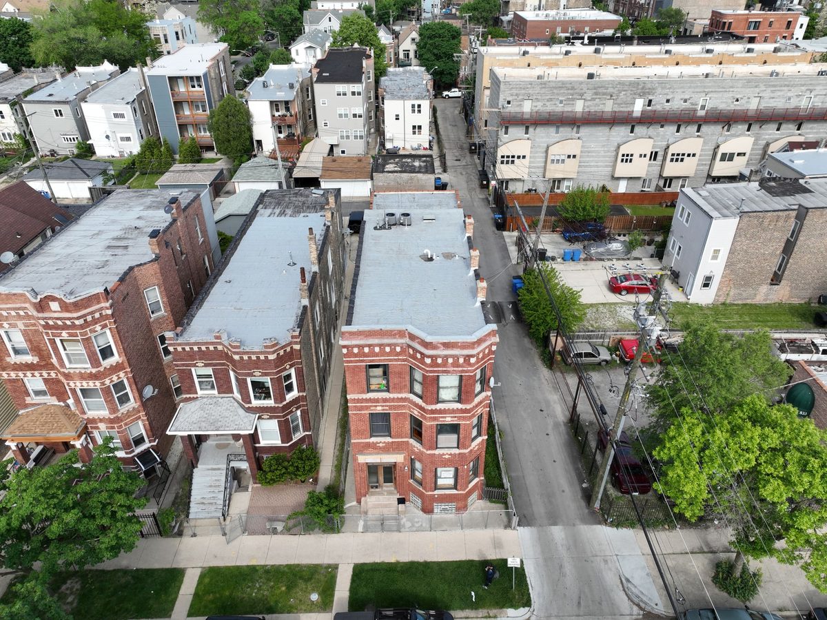
Roof, parapet, chimneys and rear elevation in one pass.
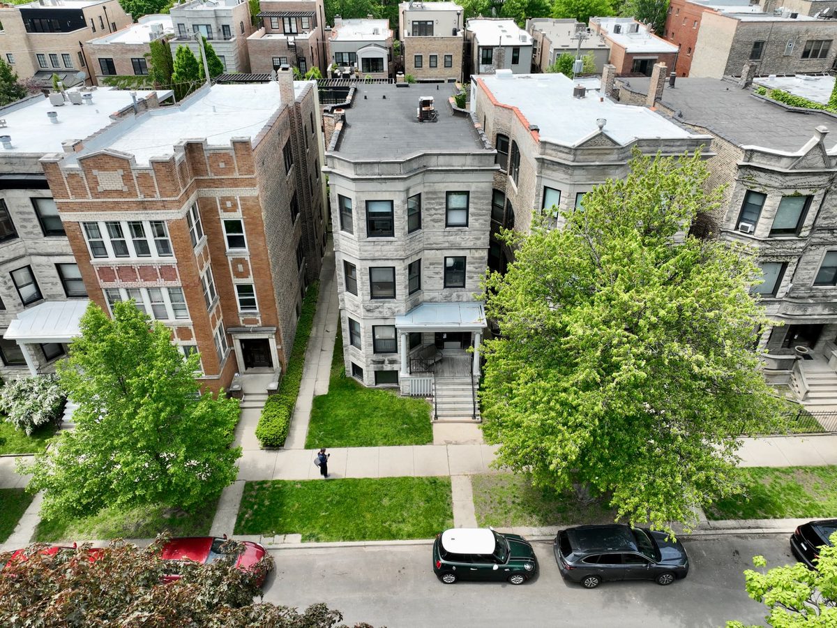
Street elevations at a fixed standoff, comparable year to year.
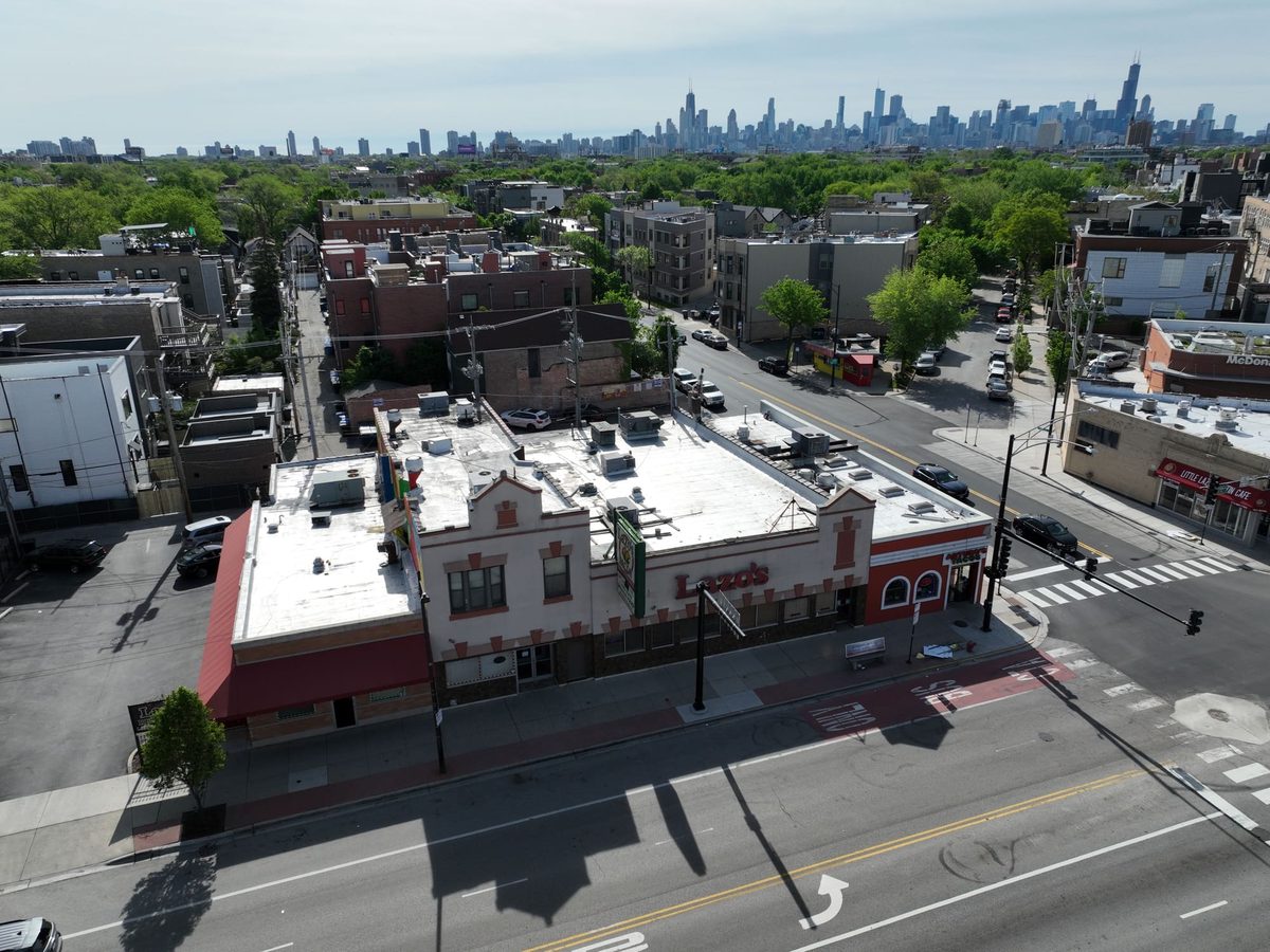
Roof membrane and rooftop units documented without a lift.
The Air + Ground Survey
Parking structures, building investigations and construction projects often need the elevations documented from the air and the concrete mapped from the ground. One call starts both.
Call
Tell us the building and the question you need answered. We’ll say which side the job needs, or both.
Plan
Airspace, LAANC authorization and site access are arranged before the flight date, never the morning of.
Fly
Every elevation at a fixed standoff and overlap, with detail passes where something warrants a closer look. Thermal flies after sunset or in cold weather, when the contrast is real.
Scan
Where the job needs the inside of the concrete, GPIS marks rebar, conduit and post-tension cable on the surface before anyone cuts.
Report
Camber delivers a written condition report, area by area, within five business days. GPIS delivers its end-of-job PDF. Two reports, one job.
Two companies, one job. Camber Aerial and GPIS GPR Concrete Scanning work as independent companies, each reporting in its own name and each responsible for its own scope, pricing, findings and insurance.
A plain-English report, not a photo dump.
Every survey ends in a written report: what was flown, the condition of each area, photos of anything worth noting, and what to do next. Sometimes the answer is that nothing needs fixing, which is worth knowing too. Full-resolution stills are retained if your engineer or architect needs them later.
Roof & Exterior Survey
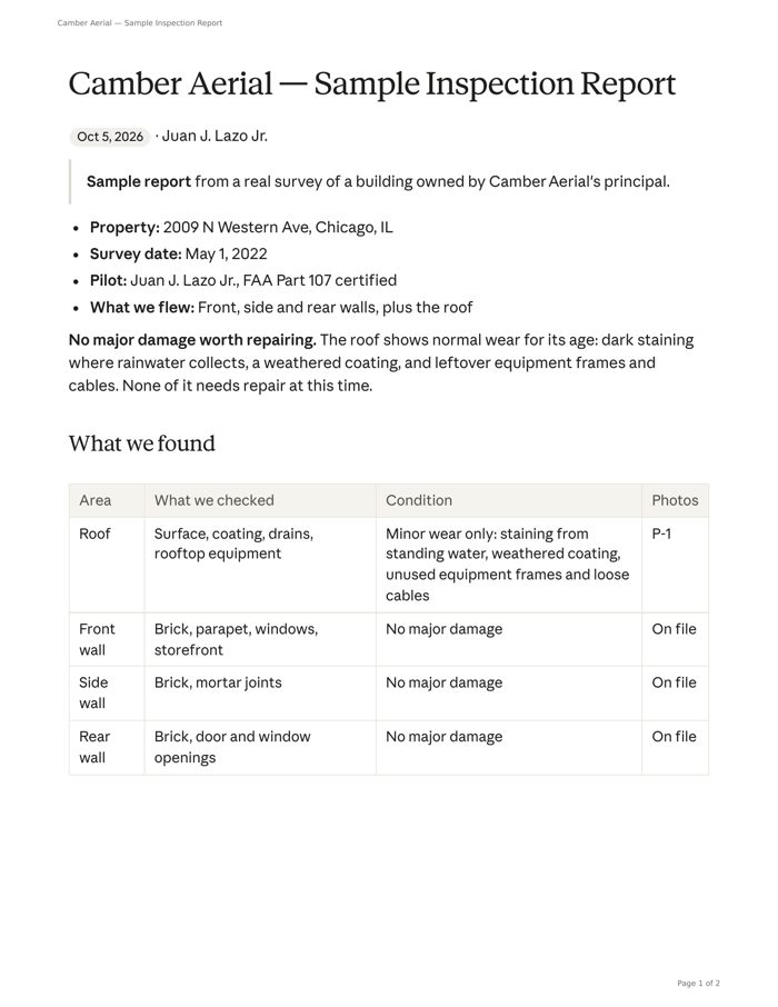
A Chicago building owned by Camber’s principal, flown May 2022
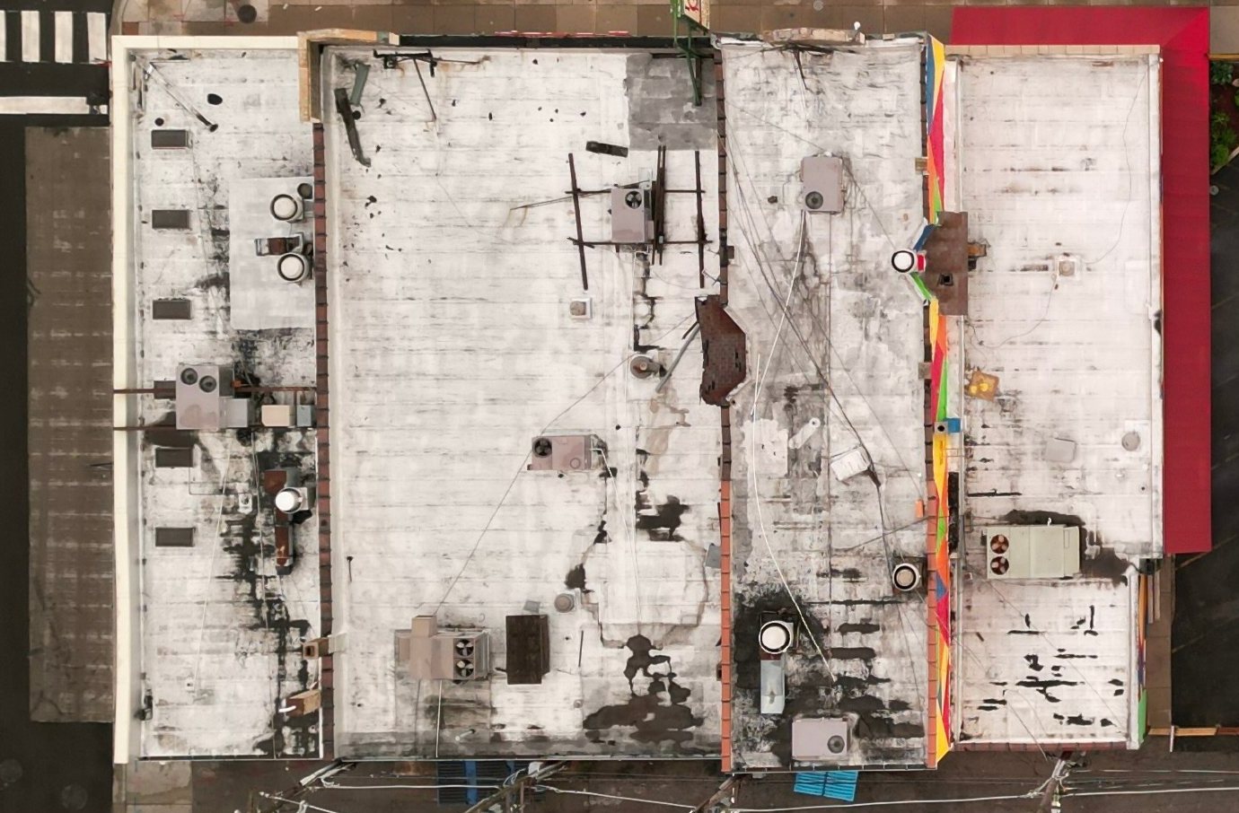
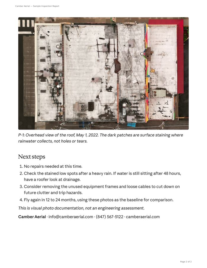
Photo P-1 from the report. The dark patches are surface staining where rainwater collects, not holes or tears.
Front, side and rear walls, plus the roof.
Normal wear for the roof’s age. No repair needed.
Recheck the stained low spots after heavy rain. Fly again in 12 to 24 months, using these photos as the baseline.
PDF · 2 pages · opens in a new tab
◆ Facade & building envelope
◆ Thermal & moisture
◆ Deliverable
Written condition report, area by area, with photos and next steps
Full-resolution stills, retained and re-deliverable
Within 5 business days of the flight
Quoted per project. Same-day number for most work
the season.
The cold that stops most drone work is what makes thermal work possible. An envelope heat-loss survey needs the indoor-to-outdoor temperature difference a Chicago winter provides, and roof moisture surveys fly after sunset year-round. A scan flown at the wrong hour produces confident-looking imagery of nothing, so scheduling around the right window is part of the job.
Two numbers. Pick the one for your question.
Facade, roof or thermal
Camber Aerial LLC. You reach the pilot, Juan Lazo Jr.
Rebar, conduit or post-tension
GPIS GPR Concrete Scanning & Imaging. You reach Paul.
Not sure which? Call GPIS. We’ll tell you straight whether the job needs a camera in the air, radar on the ground, or both. No charge for the conversation.